The mapping devices recommended by IndoorAtlas are listed in supported devices. In case you don’t have any of the devices in the above list at hand, you can test if a device you possess matches the criteria of a good mapping device.
Perform tests
Install IndoorAtlas MapCreator on the device. This verifies that the required sensors exist. MapCreator requires hardware magnetometer and gyroscope sensors with access to uncalibrated data.
Do gyroscope and magnetometer calibrations using MapCreator. This verifies that the sensors function well.
Record one path, longer than 20m.
Analyse results
Recommended Device
A device is recommended for mapping if you see the following:
- Wi-Fi mapping coverage image after a single path is orange-green.
- Wi-Fi mapping coverage image is green after collecting two overlapping paths on the same corridor.

Wi-Fi mapping coverage, one path: Recommended device
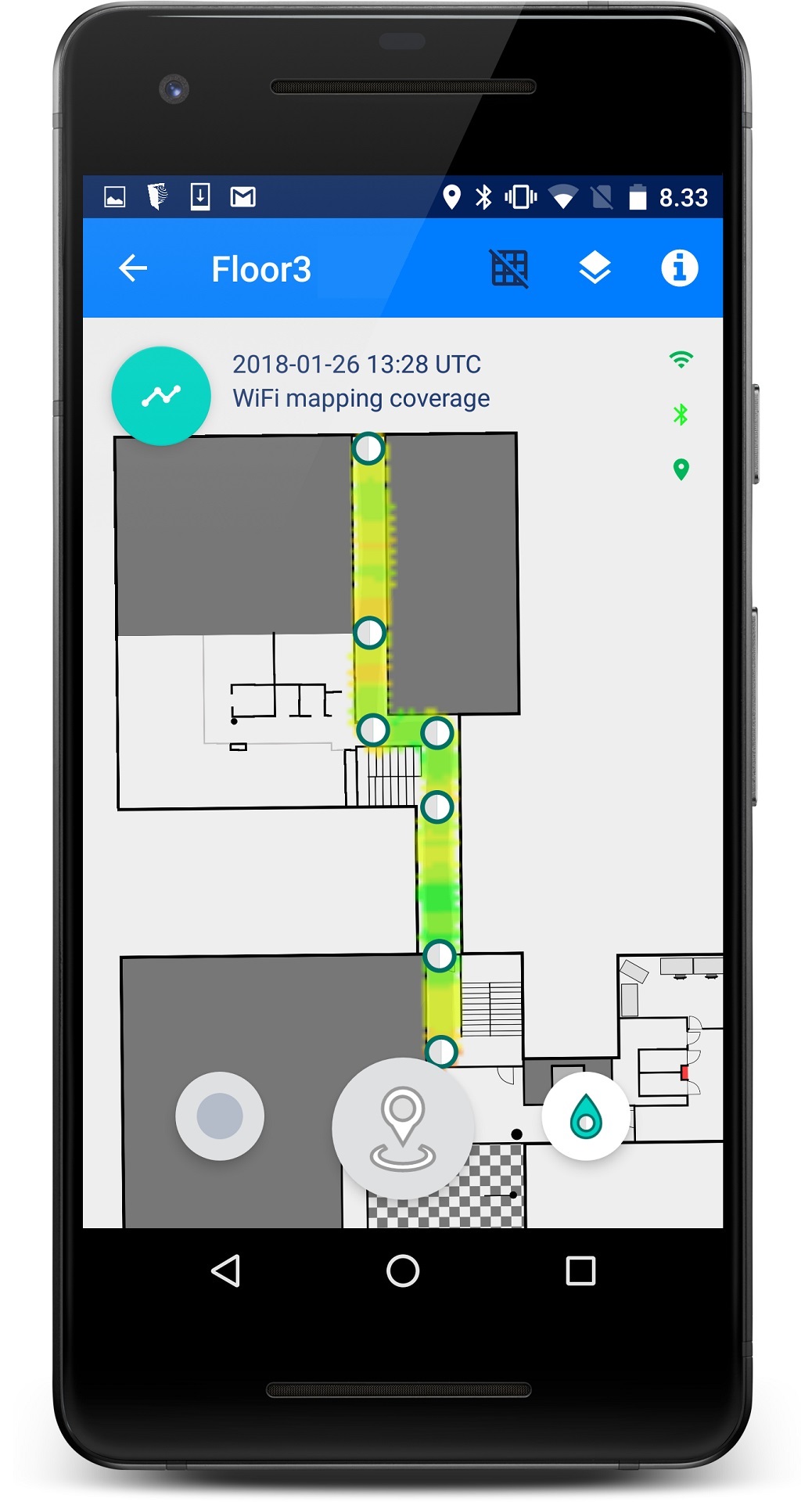
Wi-Fi mapping coverage, two paths: Recommended device
Not a Recommended Device
A device is not recommended for mapping if you see the following:
MapCreator warns about Wi-Fi scanning quality. See image below.
Wi-Fi mapping coverage image after single path from MapCreator is red-orange.
Wi-Fi mapping coverage image is not green after collecting two overlapping paths on the same corridor.
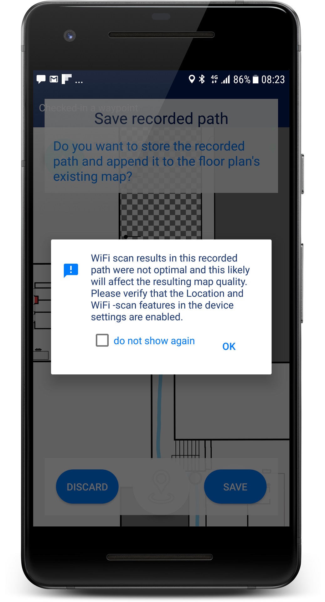
Wi-Fi scanning warning : Not recommended device
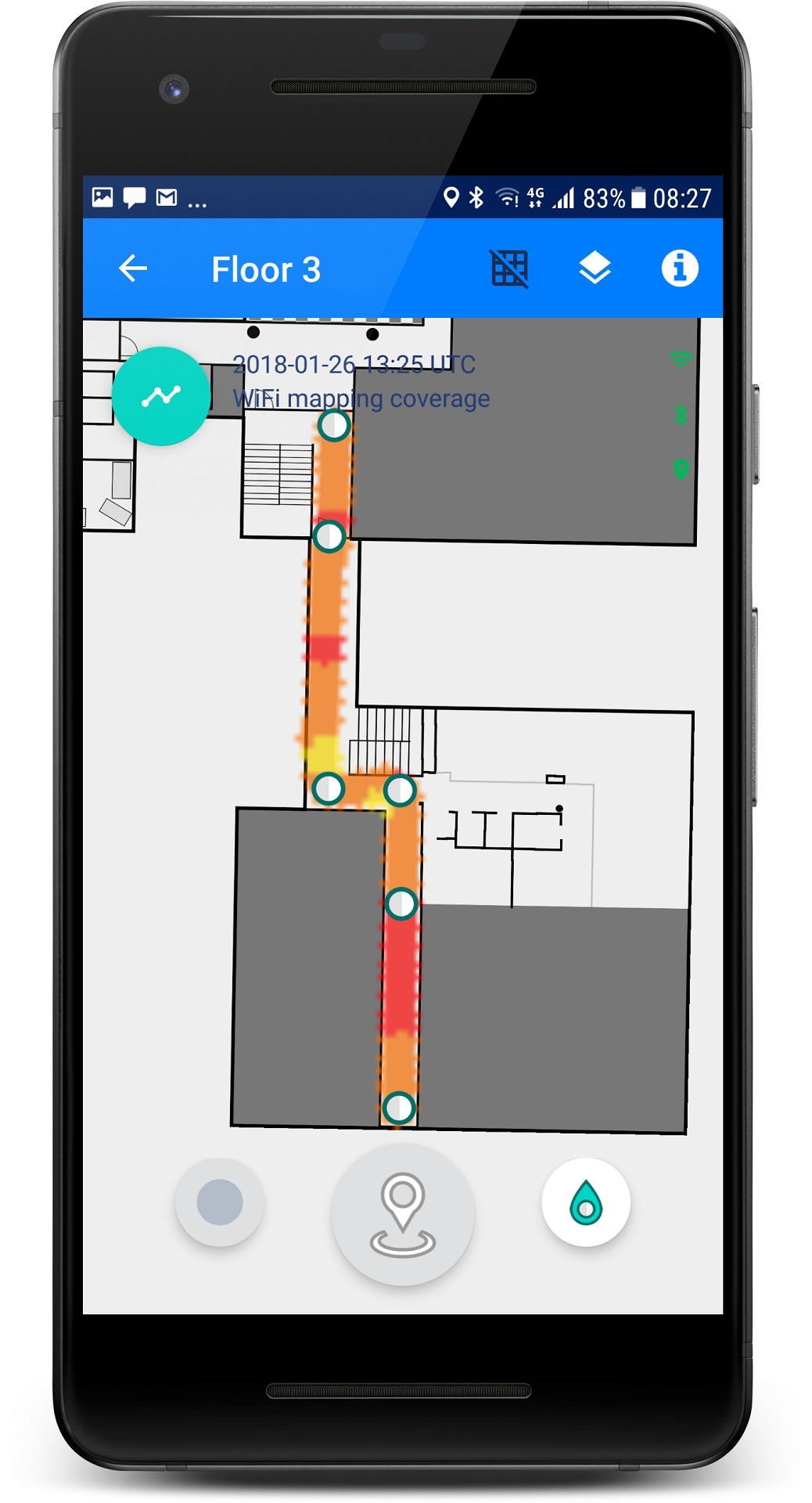
Wi-Fi mapping coverage, one path : Not recommended device
Note that in practice using a device that is not recommended means that you need to spend more time mapping on the same areas to achieve similar performance. This may be acceptable for small scale testing, but is not practical in production mapping.
To emphasize, neither of the devices produces ideal Wi-Fi mapping coverage on a single pass through a corridor/area. After a second path through the corridor the coverage image of the recommended device gets green. Note that in wide corridors IndoorAtlas also recommends two parallel paths to achieve good geomagnetic coverage.